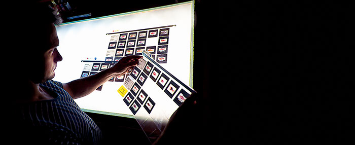
 Daniel Gledhill examines slides archived in CSIRO"s Australian National Fish Collection, which have been used developing FishMap.
 Photo: Carlie Devine, CSIRO
By Catherine Norwood
Australia’s marine diversity is among the richest in the world, but that richness creates challenges for anyone trying to identify and record marine organisms.
With these challenges in mind, CSIRO recently launched the free online tool FishMap, a searchable atlas of more than 4500 marine fishes. It can rapidly produce regional, illustrated lists of species occurring in the marine waters of Australia’s continental shelf and slope, with distribution maps and current scientific and common names.
FishMap builds on more than a century of research by Australian marine scientists and on the work of museums and fisheries research and management agencies across Australia.
CSIRO researcher Daniel Gledhill led the project to collate existing identification and distribution information as part of a three-year project jointly funded by CSIRO’s Wealth from Oceans Flagship and the Atlas of Living Australia.
Gathering history
Daniel Gledhill says FishMap incorporates data on Australian fishes dating back to European scientific expeditions undertaken around Australia in the early 1800s. Illustrations used in the tool date to at least the early 1900s and include line drawings, colour paintings and photographs.
“We scoured national and international image collections and have managed to track down illustrations for more than 90 per cent of the fish species listed. Most images are in colour, which can be very important in identifying one species from another.”
Daniel Gledhill says the identification and distribution information used to create FishMap has come from a wide range of research and management agencies, but additional information is still needed for many species.
“Some fish may be known from only one or two specimens. New species are also still being identified on a regular basis. With new information, even common species – for example, a species found on both the east and west coast of Australia – are sometimes found to be two different species that have previously been confused.”
He says FishMap is the only resource of its kind in the world that covers virtually all species of marine fish found in the marine waters of an entire continent.
“The sheer diversity of fish species can make it difficult for people to get a handle on anything that is a bit unusual. Things that we see regularly may be quite easy, but as soon as someone catches something that’s a little off the beaten track, so to speak, it becomes very difficult to even find out what species might be in the local area.
“With FishMap you can search by depth, you can search by whether you’re fishing on the bottom or in the water column, and you can also search by individual families of fish. For example, there are more than 40 species of flathead in Australia; if you catch one you don’t recognise, FishMap is a starting point to find what species may live in that location.”
He cautions that FishMap is not a complete identification tool. At this stage it provides broad coverage of the fauna and will be updated regularly with more species and additional information.
For researchers undertaking fieldwork, FishMap can provide a list of species that might occur in the area of interest, with the current scientific name, common name and illustrations.
This could help reduce the amount of replication of out-of-date names, and also incorrect names that are used in some datasets. Simple guides or data can be downloaded into a spreadsheet to create templates for data collection.
Unidentified species
FishMap can provide a starting point for identifying unusual species. Fishers wanting to report unusual sightings will also be interested in RedMap, a website that aims to capture data on marine species whose ranges are extending in response to warming waters.
Daniel Gledhill says identification of what seems to be a new or rare species could require the expertise of the fisheries staff of a state museum.
“If you find something really unusual your state museum is also a good place to turn for assistance. Specimens should be photographed before being wrapped in plastic bags and frozen, and the photographs sent to the local museum. There are many species you can’t identify from a photograph, so keeping the specimen can really help.”
Once formally identified and named, any new species will make its way into FishMap, he says.
FishMap was co-developed by CSIRO’s Wealth from Oceans National Research Flagship and the federally funded initiative The Atlas of Living Australia. The Atlas aims to bring the rich data from Australia’s biological collections to the fingertips of everyone from scientists to the public.
More information
Daniel Gledhill, daniel.gledhill@csiro.au