The first national study of Australia’s trawling footprint has identified contact with less than 3.5 per cent of the seabed
By Melissa Marino
Australia"s Trawl Footprint.
Source: FRDC
Australia’s seabed is incredibly diverse, ranging from kelp forests to coral reefs, and rocky escarpments to sandy plains. Some of these seascapes are sensitive to the impact of trawl fishing, while others are less so.
A recent FRDC project has mapped the footprint of Australia’s trawl sector, as well as mapping these seabed ecosystems, or eco-regions, to identify broad types of sea floor habitats in trawled areas.
The project, which defined and mapped 217 different eco-regions, also found that trawling has occurred over just 3.5 per cent of the continental shelf and slope seabed. This represents just 1.2 per cent of Australia’s 8.2 million square kilometres of marine estate.
“Combining the trawl footprint with eco-region mapping allows fisheries managers to focus more closely on the sea floor eco-regions where most trawling occurs, to identify and map any sensitive habitats and put mitigation strategies in place,” says CSIRO’s Roland Pitcher, who led the research.
Trawl footprint
Overall, the findings showed that Australia’s trawl footprint was relatively small. Most of the 217 seabed eco-regions defined and mapped had little or no exposure to trawling.
Roland Pitcher has been involved in a parallel international research project that studied 24 regions worldwide. Five of these were in Australia, and had among the smallest trawl footprints of less than 10 per cent. In contrast, four of nine European regions had footprints of more than 50 per cent.
The international research, published in 2018 in the Proceedings of the National Academy of Sciences of the United States of America, showed the average trawl footprint – measured using high-resolution trawl effort data – was 14 per cent across all studied regions. (The regions excluded South-East Asia due to a lack of data.)
Roland Pitcher says both the international research and the recent Australian project demonstrate the footprint of trawling on the seabed is substantively smaller than that of agriculture and other human activities on land, which Australian Bureau of Statistics data indicates is up to 45.2 per cent of the continent’s land area.
By way of comparison, the total trawl footprint was about 100,000 square kilometres – the equivalent of 1.3 per cent of the landmass. This was based on data covering up to five years of recent fishing activity.
Within the trawl footprint, researchers estimated that between 4000 and 13,000 square kilometres were trawled intensively, which has greater potential to modify sensitive habitats.
This is also why mapping the seabed eco-regions as part of the trawl mapping has been so important. The data can be used to build a national picture of the sea floor for use in marine management decisions, in the same way that soil and vegetation maps are used in land-based decision-making.
“If a habitat is relatively limited, then a relatively small amount of trawling would potentially be more concerning than the same amount of trawling in a habitat extent that is quite large and common,” Roland Pitcher says.
Assessing risk
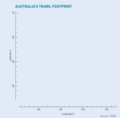
Trawler operating in Far North Queensland.
Photo: Chris Bolton Fishing
In some eco-regions, including in the Great Barrier Reef and the Torres Strait Prawn Fishery, extensive habitat data is available. Some habitat data is also available for the south-east region, near the southern NSW–Victoria border, and the continental shelf break off Tasmania.
But in many areas, where the trawl footprint is heaviest, we need more information about seabed habitat types, Roland Pitcher says.
“Our recommendation is that fisheries managers, government departments and the FRDC need to consider these regions as future priorities for research to discover and map what lives on the seabed, and then to make quantitative risk assessments,” he says.
Areas identified as highest priority for further assessment are:
- the Australian east coast from southern Queensland including deep areas of the southern Great Barrier Reef;
- shelf areas of NSW and eastern Victoria to Bass Strait;
- western Tasmania to south-east South Australia near the continental shelf break;
- the outer Great Australian Bight off South Australia and Western Australia; and
- Shark Bay in Western Australia.
“Some eco-regions in these areas have high trawl footprints (between 30 and 65 per cent trawled) and typically have low protection (such as in marine reserves or fishery closures), and will need to be assessed first,” Roland Pitcher says.
When new ecological data has been collected, he says that more accurate assessments can be made about levels of risk from trawling.
For example, if there is a large trawl footprint in a sensitive habitat, the potential for risk is higher. Alternatively, in habitats with high ecological resilience, there might be a high trawl footprint, but the impacts will not be as substantial. And in areas where the trawl footprint is low, there is unlikely to be ongoing risk to habitat.
He says that CSIRO video footage recorded over thousands of kilometres of seabed shows about 95 per cent of the bottom consists of sandy or muddy habitat that appears relatively bare on the surface, and is relatively resilient to trawl nets. But, he says that delicate habitats have been seen in some places, “so the job is to map where they are”.
Way forward
Roland Pitcher, Researcher.
The FRDC-funded report builds on a substantial body of work into trawl impact undertaken by Roland Pitcher and his colleagues.
Past research has often focused on bycatch to determine species at risk. Looking at habitat provides a new insight, says Dan Corrie, manager of the South East Trawl and Great Australian Bight Trawl Fishery for the Australian Fisheries Management Authority.
“For our main fish species we have quantitative risk assessments where we use fisheries data to make informed decisions, but for habitat it’s been lacking,” he says.
“This provides us with information about habitats and their distribution and what the potential impact of trawling is in particular areas.”
Dan Corrie says the research is valuable because it indicates which areas could be affected the most and therefore where management efforts should be focused.
“The management response will largely depend on the outcome of any future risk assessments, but for now, at least from this research, we know if there are any areas we want to focus on.”
The data collected through the research will also help inform the public, because trawling is often portrayed as destructive in the media, Roland Pitcher says.
“But if we actually dig into it and look at what the trawling footprint is, it’s relatively light, especially compared with terrestrial land uses that people accept,” he says.
Simon Boag, CEO of the South East Trawl Fishing Industry Association, says the trawl industry is excited about telling the story this research reveals.
“This report shows us that the 388,000 square kilometres of the south-east’s marine parks have worked in limiting the trawl footprint to one of the lowest in the world,” he says. “This is very different to how some conservation groups portray trawling.”
Dan Corrie says the research provides industry with “a bit of social licence” by helping to put the trawl footprint in perspective.
“There is a perception that trawling is spread far and wide and has a big impact on the benthos. It’s true that where trawling does occur there is a level of impact, but what this research shows is the footprint is not nearly as big as what it may have been perceived to be.”
Roland Pitcher says the research sets a baseline from which updated and new data, including the further mapping of sensitive habitats, can be added to continue building the full picture of the trawl impact in Australian waters.
“There’s largely a good message in Australia’s low overall trawl footprint, but also a message of things we have to do and look at more closely in the future,” he says.
“Those eco-regions identified as high priorities should be looked at to find out what they’ve got in the way of sensitive habitats. Map them, and understand in detail where trawling occurs relative to habitat, so there can be a quantitative assessment of whether there is a risk of ongoing adverse impacts to those habitats or not. That’s what I would like to see happen.”
The report, Putting potential environmental risk of Australia’s trawl fisheries in landscape perspective: exposure of seabed assemblages to trawling and inclusion in closures and reserves is available here.
FRDC Research Code: 2016-039
More information
Roland Pitcher, CSIRO Oceans & Atmosphere
07 3833 5954
roland.pitcher@csiro